St Kilda, Hirta
Martin Martin
The first of these names is taken from one Kilder, who lived here; and from him the large well Tobar-Childa has also its name. Hirta is taken from the Irish Ier, which in that language signifies west: this isle lies directly opposite to the isles of North Uist and Harris. It is reckoned 18 leagues from the former, and 20 from Harris. This isle is by Peter Goas, in a map he made of it at Rotterdam, called St. Kilder; it is the remotest of all the Scots north-west isles. It is about two miles in length, and one in breadth; it is faced all round with a steep rock, except the bay on the south-east, which is not a harbour fit for any vessel, though in the time of a calm one may land upon the rock, and get up into the island with a little climbing. The land rises pretty high in the middle, and there is one mountain higher than any other part of the island….
Martin Martin visited and mapped St Kilda in 1697 as part of a project to describe the Western Isles of Scotland. Today his findings are out of copyright and available on the internet.
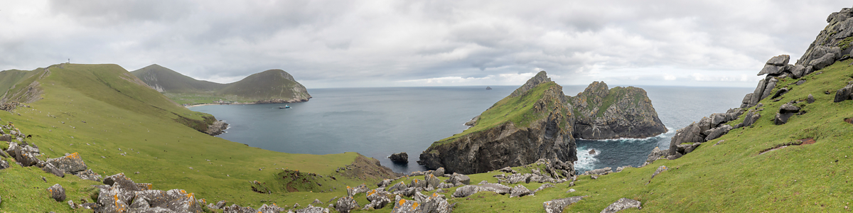
Hirta is the largest island of the St Kilda archipelago. Fair winds given one sails about 35 nautical miles across the Atlantic from the Outer Hebrides to Village Bay – the bay at the south-east of Hirta which according to Martin Martin “is not a harbour fit for any vessel”.


Dùn shields Village Bay to the south and was the place of a now sunken and name giving Fort at its easternmost end.


The last permanent inhabitants of St Kilda who were evacuated in 1930 stored the goods to trade with their landlord in the Feather Store at the northern shore of Village Bay.


The canon was installed at the end of World War I. Never has it been used.
Turf covered Cleits were used to store food vented by fresh air and shielded against rain. About 1.200 of them still can be counted on the island. Early houses looked similar to Cleits but had insulated walls. Souterrains can also be found on St Kilda, archaeologists still aren’t sure whether these earth houses served as houses or store only.


Soay sheep roam around freely. They are left alone by men except giving a blood sample for DNA analysis once in their lifetime. This test in situ started in the 1950s when the National Trust for Scotland inherited the archipelago.


")


Fulmars loving steep cliffs for breeding discovered the Cleit tops as perfect resting places.
Until they finally left their home the St Kildans lived in “The Village”.


Factor’s House and the church with the adjacent school room were among the first buildings National Trust for Scotland work parties restored.


")

There is only one “street” all houses are lined along.


The great glen (Gaelic: Glen Mor) opens to the north and bears traces of early settlement as well as war remains.


, covered Conachair (376 m)")
 and Conachair (376 m)")
Without modern navigational aids there is a high risk for planes to hit the often mist covered Conachair (376 m), the highest mountain on Hirta.
 towers above \"The Village\"")

Boreray and its surrounding stacks (Gaelic: Stac, the word for a sea stack commonly used in Scotland) rival Bass Rock housing the largest colony of northern gannets in Europe.

 and Boreray")
")
")
")
")
")
")
")

Prominent rock formations draw the coastline of the St Kilda archipelago. Hirta’s sea cliffs are the highest in the United Kingdom.


